Serveis de Captura
Oferim solucions de dades espacials de principi a fi, capturant condicions del món real, processant-les amb tècniques avançades, i lliurant resultats digitals d'alt valor adaptats al disseny, la construcció, la inspecció i les operacions.
Drone LiDAR
Geometria 3D d'alta densitat del terreny, edificis i infraestructura ben adaptada per a llocs grans o visualment complexos.
Resultats: Núvols de punts | Models de superfície | Volumetries
Fotogrametria amb Drone
Imatges aèries superposades transformades en mapes precisos i models 3D detallats per al context i la documentació.
Resultats: Ortomosaics | Malles 3D | Núvols de punts
Drone Tèrmic
Dades aèries infraroges que revelen patrons de temperatura i anomalies sense contacte físic.
Resultats: Mapes tèrmics | Superposicions de calor | Informes visuals
LiDAR SLAM mòbil
Captura 3D ràpida d'espais interiors i complexos mitjançant sistemes LiDAR portàtils ideals on GPS o drons no són pràctics.
Resultats: Núvols de punts | Plànols de planta | Geometria 3D
Tèrmic SLAM Mòbil
Dades tèrmiques combinades amb posicionament espacial per visualitzar la variació de temperatura a través d'entorns interiors i exteriors.
Resultats: Núvols de punts tèrmiques · Models amb mapa de calor
Captura d'Imatges 360º
Imatges panoràmiques d'alta resolució per a documentació immersiva i recorreguts visuals.
Resultats: Visites virtuals | Registres visuals
Tècniques de Processament
Com processem les dades que recopilem
Fotogrametria
Converteix imatges superposades en conjunts de dades 2D i 3D espacialment consistents.
Termogrametria
Processa imatges tèrmiques en mapes de temperatura alineats per a diagnòstics i anàlisi.
Gaussian Splatting
Tècnica de renderització neuronal que produeix escenes 3D suaus i fotorealistes per a visualització i presentació.
Resultats de Dades
Els lliuraments digitals finals produïts a partir de dades de captura processades, dissenyats per a visualització, anàlisi, documentació i presa de decisions en disseny, construcció, immobiliària i fluxos de treball industrials.
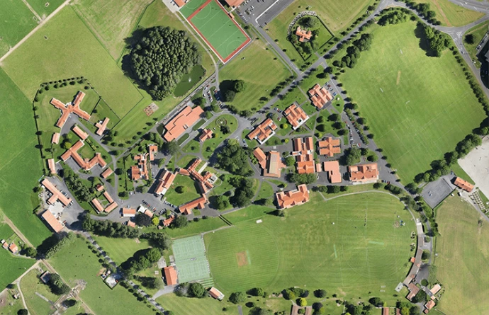
Ortomosaics
Una imatge sense costures, alineada amb el mapa, creada unint diverses fotografies aèries superposades. Els ortomosaics proporcionen una representació visual consistent d'un lloc, corregida per perspectiva i distorsió del terreny.
Millor per: AEC | Planificació | Immobiliària | Documentació del lloc
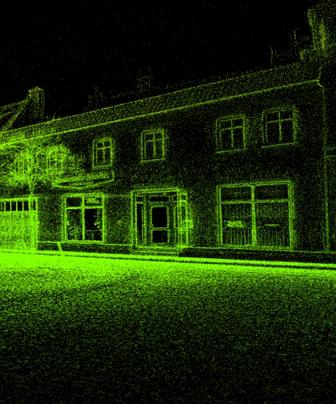
Models de Gaussian Splat
Una representació de escena 3D fotorrealista optimitzada per a la visualització en temps real i la visualització immersiva. Els Gaussian Splats preserven el detall visual i la continuïtat sense requerir geometria de malla tradicional.
Millor per: Visualització | Germans digitals | Immobiliària | Comunicació amb les parts interessades
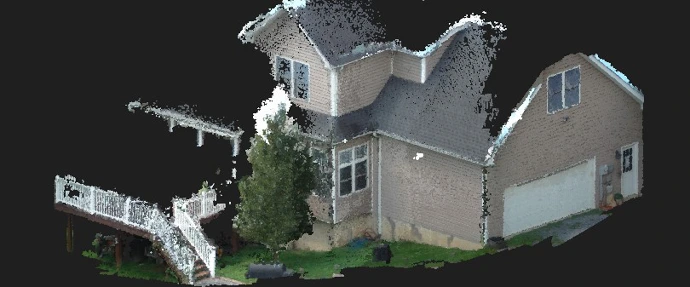
Núvols de punts
Un conjunt de dades tridimensionals compost per milions de punts individuals, cadascun representant una ubicació en l'espai. Els núvols de punts formen la base per a molts fluxos de treball espacials i actuen com una font flexible per a la modelització, l'anàlisi i la visualització.
Millor per: AEC | Industrial | Instal·lacions | Modelatge de condicions existents
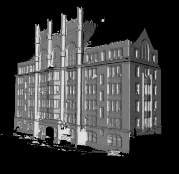
Models de malla 3D
Un model de superfície continu creat connectant dades espacials en cares i polígons, formant una representació tridimensional completa d'objectes o entorns. Els models de malla equilibren l'estructura geomètrica amb la claredat visual.
Millor per: Visualització | Germans digitals | Revisió de disseny | Simulació
Entendre el tipus de treball que fem és el següent pas per treballar amb nosaltres
Fes una immersió més profunda en casos d'ús del món real amb els quals La Vila 3D pot ajudar.