Servicios de Captura
Ofrecemos soluciones de datos espaciales de extremo a extremo, capturando condiciones del mundo real, procesándolas con técnicas avanzadas y entregando salidas digitales de alto valor diseñadas para el diseño, la construcción, la inspección y las operaciones.
LiDAR de Drones
Geometría 3D de alta densidad del terreno, edificios y infraestructura, bien adecuada para sitios grandes o visualmente complejos.
Resultados: Nubes de puntos | Modelos de superficie | Volumetrías
Fotogrametría de Drones
Imágenes aéreas superpuestas transformadas en mapas precisos y modelos 3D detallados para contexto y documentación.
Resultados: Ortomosaicos | Mallas 3D | Nubes de puntos
Térmico de Drones
Datos aéreos infrarrojos que revelan patrones de temperatura y anomalías sin contacto físico.
Resultados: Mapas térmicos | Superposiciones de calor | Informes visuales
LiDAR SLAM Móvil
Captura 3D rápida de espacios interiores y complejos utilizando sistemas de LiDAR portátiles ideales donde GPS o drones no son prácticos.
Resultados: Nubes de puntos | Diseños de planta | Geometría 3D
Térmico SLAM Móvil
Datos térmicos combinados con posicionamiento espacial para visualizar variación de temperatura en entornos interiores y exteriores.
Resultados: Nubes de puntos térmicos · Modelos mapeados por calor
Captura de Imagen 360º
Imágenes panorámicas de alta resolución para documentación y recorridos visuales inmersivos.
Resultados: Tours virtuales | Registros visuales
Processing Techniques
Cómo procesamos los datos que recopilamos
Fotogrametría
Convierte imágenes superpuestas en conjuntos de datos 2D y 3D espacialmente consistentes.
Termogrametría
Procesa imágenes térmicas en mapas de temperatura alineados para diagnósticos y análisis.
Splatting Gaussiano
Técnica de renderizado neural que produce escenas 3D suaves y fotorrealistas para visualización y presentación.
Salidas de Datos
Los entregables digitales finales producidos a partir de datos de captura procesados, diseñados para visualización, análisis, documentación y toma de decisiones en diseño, construcción, bienes raíces y flujos de trabajo industriales.
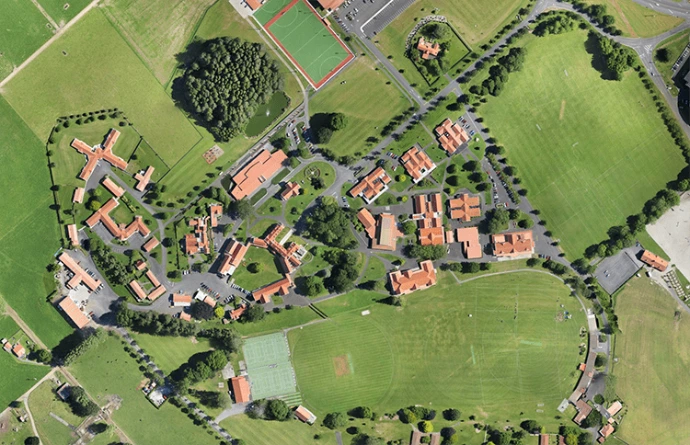
Ortomosaicos
Una imagen sin costuras, alineada con el mapa, creada al coser múltiples fotografías aéreas superpuestas. Los ortomosaicos proporcionan una representación visual consistente de un sitio, corregida por perspectiva y distorsión del terreno.
Mejor para: AEC | Planificación | Bienes raíces | Documentación del sitio
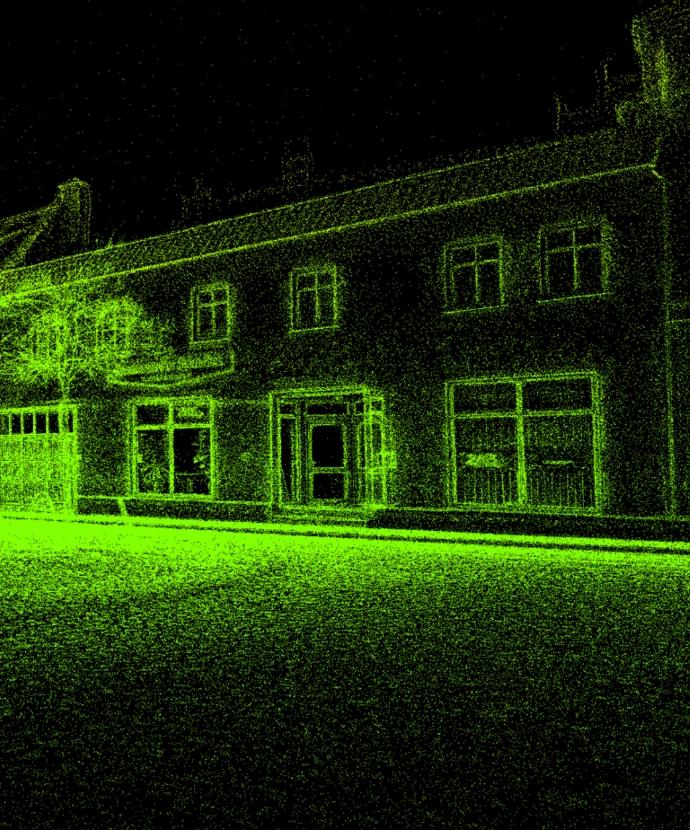
Modelos de Splat Gaussianos
Una representación de escena 3D fotorrealista optimizada para visualización en tiempo real y visualización inmersiva. Los Gaussian Splats preservan el detalle visual y la continuidad sin requerir geometría de malla tradicional.
Mejor para: Visualización | Gemelos digitales | Bienes raíces | Comunicación con partes interesadas
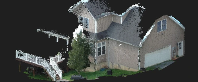
Nubes de Puntos
Un conjunto de datos tridimensional compuesto por millones de puntos individuales, cada uno representando una ubicación en el espacio. Las nubes de puntos forman la base para muchos flujos de trabajo espaciales y actúan como una fuente flexible para modelado, análisis y visualización.
Mejor para: AEC | Industrial | Instalaciones | Modelado de condiciones existentes
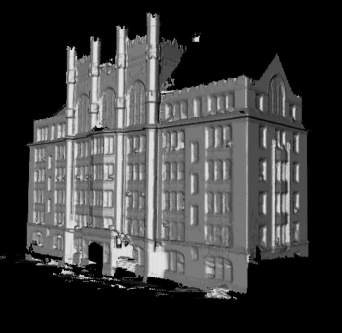
Modelos de Malla 3D
Un modelo de superficie continua creado al conectar datos espaciales en caras y polígonos, formando una representación tridimensional completa de objetos o entornos. Los modelos de malla equilibran la estructura geométrica con la claridad visual.
Mejor para: Visualización | Gemelos digitales | Revisión de diseño | Simulación
Entender el tipo de trabajo que hacemos es el siguiente paso para trabajar con nosotros
Profundiza en casos de uso del mundo real en los que La Vila 3D puede ayudar.